SunsetVue

Photo locations · Walensee · Switzerland

Chapf above Amden: sunset photography forecast

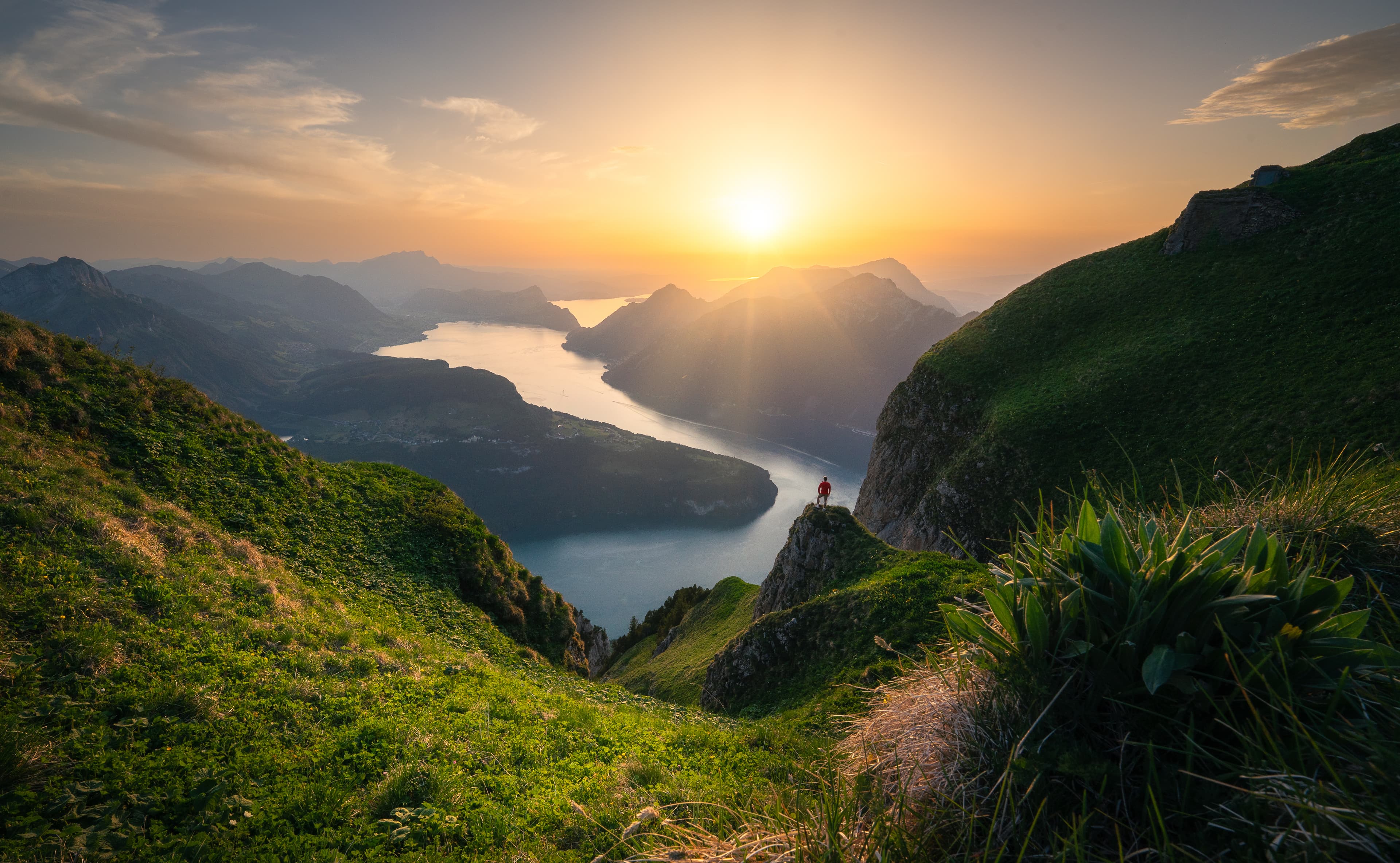
Chapf is a platform on the edge of the slope above Amden, with the Walensee a long way down and the Glarus Alps standing opposite. The walk is about twenty minutes and almost flat, which is a rare combination for a view this steep. There are benches and a panorama board when you get there.

Will today's sunset be worth it?

Chapf above Amden · forecast for sunset

Sunset: No Sunset

Sun likely hidden

18:51

in 2h 55m, local time

Only one forecast available

Why: Precipitation is likely nearby (100% at one or more sample points) — most direct light will be blocked, though a showery sky can still open up.

2 km4 km6 km8 km10 km12 kmNear-ground relative humidity18% cover — too thin to draw as cloud11% cover — too thin to draw as cloudConnected cloud layer · 0–100% cover · 45–100% visual uncertaintyConnected cloud layer · 0–100% cover · 45–100% visual uncertaintyConnected cloud layer · 0–100% cover · 45–100% visual uncertaintyConnected cloud layer · 18–100% cover · 45–100% visual uncertaintyConnected cloud layer · 0–100% cover · 10–45% visual uncertaintyConnected cloud layer · 58–100% cover · 10–45% visual uncertaintyConnected cloud layer · 27–100% cover · 10–25% visual uncertaintyConnected cloud layer · 100–100% cover · 10–10% visual uncertainty-5 km · 1.6 km of air with no pressure level in it — the decks above and below are measured, this span is not-5 km · 2.0 km of air with no pressure level in it — the decks above and below are measured, this span is not0 km · 1.6 km of air with no pressure level in it — the decks above and below are measured, this span is not0 km · 2.0 km of air with no pressure level in it — the decks above and below are measured, this span is not5 km · 1.6 km of air with no pressure level in it — the decks above and below are measured, this span is not5 km · 2.0 km of air with no pressure level in it — the decks above and below are measured, this span is not50 km · 1.6 km of air with no pressure level in it — the decks above and below are measured, this span is not100 km · 1.6 km of air with no pressure level in it — the decks above and below are measured, this span is notlow cloud · 100% reported, 76% resolved on a pressure surface — 24% is somewhere between 1.57 and 3 kmlow cloud · 100% reported, 80% resolved on a pressure surface — 20% is somewhere between 1.1 and 3 kmlow cloud · 100% reported, 72% resolved on a pressure surface — 28% is somewhere between 0.93 and 3 kmhigh cloud · 85% reported, 63% resolved on a pressure surface — 22% is somewhere between 8 and 12 kmhigh cloud · 100% reported, 33% resolved on a pressure surface — 67% is somewhere between 8 and 12 kmhigh cloud · 100% reported, 0% resolved on a pressure surface — 100% is somewhere between 8 and 12 kmlow cloud · 95% reported, 76% resolved on a pressure surface — 19% is somewhere between 0.47 and 3 kmhigh cloud · 100% reported, 0% resolved on a pressure surface — 100% is somewhere between 8 and 12 kmmid cloud · 100% reported, 0% resolved on a pressure surface — 100% is somewhere between 3 and 8 kmmid cloud · 76% reported, 0% resolved on a pressure surface — 76% is somewhere between 3 and 8 km150 km · the model says the lowest depicted cloud underside may catch orange light200 km · the model says the lowest depicted cloud underside may catch orange light200 km · the model says the lowest depicted cloud underside may catch orange light · hidden from you by opaque cloud at 50 km300 km · the model says the unresolved mid cloud may catch orange light · exact underside height unknown within 3–8 km-5You · 052050100150200300350

The sky along today's light path — cloud density by altitude, from 5 km behind you to 350 km toward the sun. Rendered by the live app.

Forecast refreshed a few hours before sunset.
Know the light
before it happens

€3.33 /month

Billed annually — €39.99

Try 14 days free

Card required, nothing charged for 14 days. Cancel any time in the trial and you pay nothing at all. EU/EEA consumers: see the right-of-withdrawal section in our Terms.

For photographers: shooting Chapf above Amden

Best months

Spring, autumn and winter. Summer works but the sun sets further round and afternoon haze softens the far side.

Suggested focal lengths

16–35 mm for the lake and the drop; 70–200 mm to pick out villages, far peaks and patches of reflected light

Composition

The height is the subject — include enough of the near slope to show how far down the lake is.

Recommended arrival

Allow the 20-minute walk plus 30 minutes to choose an angle.

Access planning

Bus or car to Amden and on to Arvenbüel, then a mostly paved walk with a short gravel section at the end.

Parking: Arvenbüel parking above Amden

Approach: About 20 minutes, mostly flat and paved

Other photo locations